The Boat Ramp On Gulf Beach Highway Doubles As Florida's Starting Line
August 27, 2026
August 27, 2026
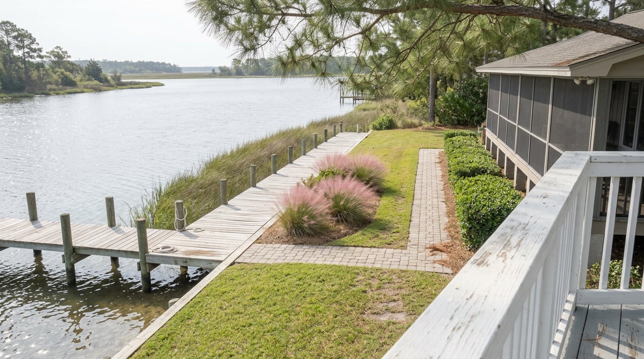
There is a weathered wooden box bolted near the sand at Big Lagoon State Park's hand-launch, and inside it is a log book. Paddlers sign it before they push off into the lagoon, and some of the names in that book belong to people who have been on the water for weeks, working their way around the entire state of Florida. If you live along Gulf Beach Highway or anywhere in the Innerarity Point corridor, you have probably driven past this launch without knowing what it actually marks. It is Mile 0 of the Florida Circumnavigational Saltwater Paddling Trail, a 1,515-mile marked route that begins here and ends here, which means the same stretch of shoreline where your neighbors put in for a Saturday morning paddle is the identical spot where someone else is closing out a monthlong trip around the whole coastline of Florida.
That single fact changes how the rest of the park reads. This is not just a quiet local green space wedged between the mainland and Perdido Key. It is a node in three separate systems that extend well past Escambia County, and just this week it was also the site of a public event tied to a federal designation the region only received recently. Here is what that actually looks like when you spend a day around it.
The paddling trail itself runs the entire perimeter of the state, and Big Lagoon is one of only two spots where it starts or finishes, depending on which direction someone is traveling. The park sits on the northern shoreline of Big Lagoon, right where the mainland gives way to the Intracoastal Waterway and, just across the water, Perdido Key. The hand-launch is a short walk from the parking area, tucked into a protected channel that keeps the water calm enough for a first-time paddler and interesting enough that serious long-distance kayakers use it as their staging point.
For residents, that means the everyday version of this launch, a Tuesday evening paddle before dinner or a slow Sunday loop out toward the marsh grass, happens on the exact same water that anchors a route drawing paddlers from well outside the region. You do not need to attempt all 1,515 miles to feel that. Knowing the number is enough to make the next quiet paddle feel different.
Big Lagoon is also a gateway site on the Great Florida Birding and Wildlife Trail, and the park's three-story observation tower is the reason. Climb it on a fall morning and you are watching more than scenery. The park is a documented stopover for more than 23 species of wood-warbler alone, along with ducks, sandpipers, and black-bellied plovers moving through on migration. The tower looks out over the lagoon and the Intracoastal Waterway toward Perdido Key, and on a clear day it is one of the better vantage points in the corridor for watching both water traffic and bird traffic at the same time.
The park also partners with the Escambia Amateur Astronomer's Association for stargazing nights, which means the same patch of ground doing double duty as a paddling trailhead and a birding checkpoint also turns into an informal observatory after dark. Few neighborhood parks stack that many uses onto one plot of land.
None of this happens in silence. NAS Pensacola sits close enough that Blue Angels practice runs are a regular part of the soundscape here, and anyone who has camped at Big Lagoon knows it. One camper reviewing the park put it plainly:
"Not the quietest state park, thanks to the Blue Angels and other Navy jets flying overhead all day."
For residents who already live with that sound as background noise, it is worth knowing it extends into the park too. It is not an interruption unique to your street. It is a shared condition of the whole corridor, from the boat ramp to the observation tower to the campground loop.
There is a more recent reason Big Lagoon has been getting attention, and it has nothing to do with paddling or birds. In December 2024, Congress designated Pensacola and Perdido Bays as Estuaries of National Significance, a status that took the Pensacola and Perdido Bays Estuary Program six years to secure. The program's executive director, Matt Posner, described part of why that designation matters in plain terms:
"Water quality has a tremendous impact on property values."
The program has been working through a restoration plan that includes rebuilding oyster habitat across the Pensacola Bay system, where an estimated 85 to 90 percent of historic oyster habitat has been lost. On August 21, 2026, the Pensacola and Perdido Bays Estuary Program held a public event directly at Big Lagoon State Park, part of the outreach work tied to that national designation. It is a small, practical detail, but it says something about how the neighborhood functions. This is not a park that gets attention because it is scenic. It gets attention because it sits at the center of an active regional restoration effort with real stakes for water quality and, per the program's own framing, for what happens to property values along the shoreline.
Getting to any of this means driving Gulf Beach Highway, which locals already know as State Road 292 in its many aliases: Sorrento Road, Perdido Key Drive, Barrancas Avenue, depending on which stretch you are on. Drivers who spent time on the highway this summer noticed a new configuration between Mills Avenue and just east of Patton Drive, where FDOT shifted travel lanes to the outside of the roadway to build a median traffic separator. It is the kind of unglamorous infrastructure project that rarely makes a resident's radar until it changes a daily commute, but it is worth knowing about if your route to the park runs through that stretch.
A day that starts at the launch usually ends a few minutes down the road. The Innerarity Point and Gulf Beach Highway corridor has its own small lineup of local spots that do not get much attention outside the neighborhood:
None of these are destination restaurants pulling from across the region. They are the places people who already live here actually go, which is a different kind of recommendation than anything you will find on a tourism site built for visitors.
None of this is a reason to move to Perdido. Most of the people reading this already live here. What it does is reframe a piece of infrastructure that is easy to take for granted. The boat ramp at the end of Gulf Beach Highway is not just a place to launch a kayak on a Saturday. It is Mile 0 of a route that circles the entire state, a checkpoint on a national birding trail, and, as of this month, an active site in a federally recognized estuary restoration effort. The Blue Angels overhead and the highway construction are part of the same fabric, not separate stories.
If you are weighing what a stretch of shoreline like this is worth, whether you are already a homeowner here or thinking about what the corridor offers long term, that context matters. Salt + Sold works this stretch of the Gulf Coast regularly and can talk through what a property near this kind of shoreline infrastructure actually means for value, access, and day-to-day life. Guiding You Home.
Stay up to date on the latest real estate trends.
The Sunchase Team are dedicated to helping you find your dream home and assisting with any selling needs you may have. Contact us today to start your home searching journey!
220 W Garden St Ste 200 Pensacola FL 32502